-
Your Government
-
- City Council Boards & Commissions Public Meetings & Minutes Municipal Code City News
- Departments Administration Building City Recorder Elections Engineering Finance Human Resources Library
- Departments Municipal Court Parks & Recreation Planning Police Public Works Reservoir Project Urban Renewal Utilities
-
-
Our Community
-
- About St. Helens History of St. HelensState of the CityCourthouse Dock Camera
- Local Events City Calendar Community Day in the Park13 Nights on the RiverIndependence Day Celebration Spirit of HalloweentownRecreation Activities Sand Island CampingKeep It Local CC
- Community Resources City Newsletter City Social Media Emergency Services New Resident InformationProtecting Our Environment
-
-
Business & Development
-
- Local Business Directory Get a Business License City Bids & RFPs Broadband Study
- Business in St. Helens St. Helens Advantages Directions & Transportation Incentives & Financing Resources for Businesses Business Guide Columbia Economic Team Chamber of Commerce
- Current City Projects Waterfront Redevelopment Public Safety Facility Strategic Work Plan
-
-
How Do I?
-
- Apply for a Job Apply for a Committee Find A Park Find COVID Info Find Forms Follow St. Helens - Facebook Follow St. Helens - Twitter Follow St. Helens - YouTube
- Get a Police Report Get a Business License Get a Library Card Get a Building Permit Newsletter Signup Past Public Meetings Pay My Water Bill
- Public Records Request Report a Nuisance Register for Rec Activity Reserve a Park Sign Up for the 911 Alerts Universal Fee Schedule
-
Nob Hill Nature Park

Nob Hill Nature Park
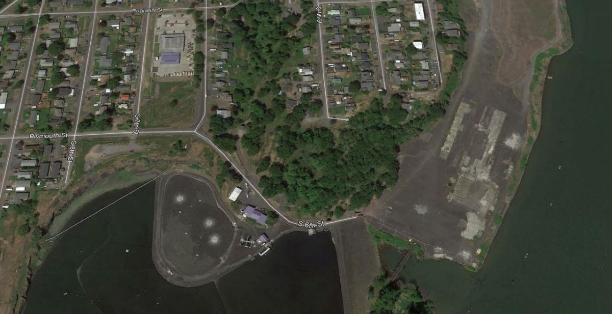
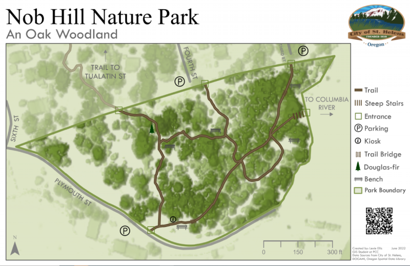
Nob Hill is an oak woodland habitat perched on a basalt bluff with views of where the Columbia River and the Multnomah Channel collide. It is filled with native white oak trees, as well as shrubs, wildflowers, and lilies. It makes a great place for bird watching and flower study. The Friends of Nob Hill Nature Park, in conjunction with the Scappoose Bay Watershed Council, hold volunteer work parties twice yearly where they work on removal of invasive plants, including English ivy, holly and blackberries. Amenities include a 1/3 mile nature trail loop with three different entrances: one by the wastewater treatment plan and the other two leading from the nearby neighborhoods on 3rd and 4th Street.
parking
Parking is allowed at the city's wastewater treatment plant, at the end of South 3rd Street, and at the end of South 4th Street.
TRAIL MAP
A larger version of this map can be found in PDF format below.

Click any thumbnail image to view a slideshow


