-
Your Government
-
- City Council Boards & Commissions Public Meetings & Minutes Municipal Code City News
- Departments Administration Building City Recorder Elections Engineering Finance Human Resources Library
- Departments Municipal Court Parks & Recreation Planning Police Public Works Reservoir Project Urban Renewal Utilities
-
-
Our Community
-
- About St. Helens History of St. HelensState of the CityCourthouse Dock Camera
- Local Events City Calendar Community Day in the Park13 Nights on the RiverIndependence Day Celebration Spirit of HalloweentownRecreation Activities Sand Island CampingKeep It Local CC
- Community Resources City Newsletter City Social Media Emergency Services New Resident InformationProtecting Our Environment
-
-
Business & Development
-
- Local Business Directory Get a Business License City Bids & RFPs Broadband Study
- Business in St. Helens St. Helens Advantages Directions & Transportation Incentives & Financing Resources for Businesses Business Guide Columbia Economic Team Chamber of Commerce
- Current City Projects Waterfront Redevelopment Public Safety Facility Strategic Work Plan
-
-
How Do I?
-
- Apply for a Job Apply for a Committee Find A Park Find COVID Info Find Forms Follow St. Helens - Facebook Follow St. Helens - Twitter Follow St. Helens - YouTube
- Get a Police Report Get a Business License Get a Library Card Get a Building Permit Newsletter Signup Past Public Meetings Pay My Water Bill
- Public Records Request Report a Nuisance Register for Rec Activity Reserve a Park Sign Up for the 911 Alerts Universal Fee Schedule
-
Branding & Wayfinding
THANK YOU to those who were involved throughout this planning process. The final Master Plan was formally adopted by Resolution at the October 18, 2017 City Council meeting. You can view the final document and appendices below.
The Project
In August 2016, the City was awarded a $40,000 grant through the 2016-2017 Travel Oregon Matching Grants Program from the St. Helens Branding & Wayfinding Master Plan. The total project budget is $80,000. In November 2016, the City selected Alta Planning & Design to work with the City to develop a community-supported plan.
The desired result is to enhance the visitor experience through strategically placed and branded signage. Enhanced gateways and unified wayfinding will help enliven the business districts of St. Helens, increasing foot traffic to businesses. It is also the hope that this project will ensure the success of the Waterfront Redevelopment Project.
Background
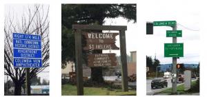
The City’s business districts are divided into three main areas: the US 30 corridor, the Riverfront District (RD), and the Houlton Business District (HBD). The RD contains a ten-block area registered on the National Register of Historic Districts with 15 locally-designated landmarks. With this historic district over a mile from US 30, visitors and even long-time residents often miss this unique shopping district, resulting in lost revenue for local small businesses. Although closer to US 30, the HBD area faces similar issues. Guiding visitors from US 30 and connecting the HBD to the RD with a comprehensive signage and wayfinding systems are primary goals of the project.
The need for a unified wayfinding signage program and brand to market the St. Helens commercial districts has been identified in numerous adopted plans, including the US 30 & Columbia Blvd./St. Helens St. Corridor Master Plan (2015) which was funded with the 2013/2014 Transportation Growth Management Grant Program. This program will also be a crucial step towards implementing recommendations from the Travel Oregon and Rural Development Initiatives-funded Sustainable Tourism Plan (2007). Both of these plans identified the lack of signage from the entrance of St. Helens on US 30 through the HBD and to the historic RD. They are included as files below.
The City is also in the process of planning for the redevelopment of over 20 acres of formerly industrial property along the Columbia River, adjacent to the historic RD. The Waterfront Redevelopment Project is the largest economic development opportunity for the City. Project goals include increased public access to the river with a riverwalk trail and enhanced open space for recreation and events that will draw residents, employers, and visitors to the area. Mixed use development, including riverview homes, retail, and marina services are also anticipated. Through initial transportation studies, the need for a brand and wayfinding signage that leads residents and visitors from US 30 to the new development along the river was identified as a necessary strategy for the success of the Waterfront Redevelopment Project.
Click any thumbnail image to view a slideshow


